← Home Archive Photos About Also on Micro.blog
  • June 27-Moline IL-Hayward WI`

    Today was a 6+ hour travel day.

    Got up, had my obligatory two yogurts, then hit the road, destination: all the way there. Left around 10:00am. Decided against a post-breakfast nap.

    Stopped in downtown Dubuque IA for lunch at a cute café. Got back on the road, crossed the Mississippi into Wisconsin and drove through many small towns.

    The speed limits in this part of Wisconsin are simple: 55 MPH in between communities, 45 MPH through unincorporated communities, 35 MPH through incorporated towns. I drove the speed limit the entire way and got passed by at nearly every passing lane.

    I went by a sign for Boaz, WI. Also passed several cheese shops, and decided to stop at the next one, which never materialized.

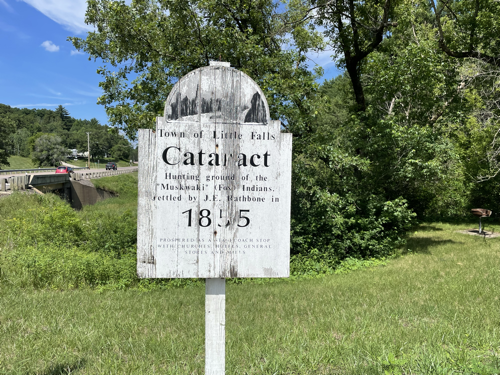
    Photo of sign advertising Cataract Wisconsin and local Indigneous tribes who historically inhabited the region

    There was a 45 mile stretch on I-94 by Osseo and up to Eau Claire that was moderately stressful due to speeds and traffic. Stopped for cheese curds and frozen custard outside of Eau Claire because I needed a snack and was craving cheese curds and frozen custard. Then back on Highway 53, a divided highway most of the way to Hayward. There were several larger towns that I went through, much to my surprise. I didn’t expect to encounter towns of around 10,000 population on this leg of the trip but sure enough.

    Got to Hayward about 6pm and went to dinner with Mom and Dad. Dinner was decent. You can definitely feel the political leanings in this part of Wisconsin in the signage and the way some people talk about the government.

    With Mom in the Prius, followed Dad back to the cabins. They’re super cute and right on a lake in Chippewa Flowage. I’m still not sure what a “flowage” is but I’m hoping to find out. I went straight to bed after getting back here, declining Mom’s offer of some dessert at their adjacent cabin.

    I’m looking forward to a chill out day tomorrow. Also I am quite overdue for some clean laundry, so will work on that tomorrow.

    → 3:00 PM, Jun 27
  • June 26th-Columbia MO-Moline IL

    When I got up, the baseball team(s) that were staying at the hotel had taken over the breakfast seating area. I decided to head for Davenport IA. Almost all of the hotels in the Quad Cities were sold out so I reserved a room at a chi-chi but reasonably affordable place in downtown Moline IL for one night. I quickly ate my oatmeal and two yogurts and hit the road.

    Pretty easy drive down country roads at first, leading eventually to the Chicago-Kansas City (C-KC) Expressway. It’s not a divided highway the whole way but it was reasonably quick in most places. Saw lots of signs for Mark Twain-related sightseeing locations. Stopped in Hannibal MO, walked around a little, found a concert in the main downtown park, and recorded some audio.

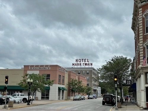
    Sign for Hotel Mark Twain in Hannibal Missouri

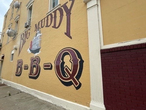
    Mural advertising BIg Muddy BBQ in Hannibal MO

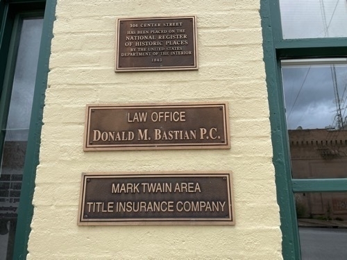
    Placard for National Register of Historic Places on side of building and sign for Mark Twain Area Title Insurance Company in downtown Hannibal Missouri

    Hannibal MO Park concert.m4a

    Hannibal MO Train passing by.m4a

    Hannibal MO Big Muddy BBQ.m4a

    Tried to find a place to grab some lunch and settled on a BBQ place in a strip mall next to a gas station. Although the setting was a little wonky, the BBQ did not disappoint. Got back on the road and crossed the Mississippi into Illinois. Took the C-KC Expressway most of the way, according to signs. I went through a bunch of small towns on the way to Moline. The smaller Illinois roads were definitely in worse shape than the equivalent roads in Missouri.

    Got to the hotel after talking with Mom and Dad who were already in northern Wisconsin at the cabin after themselves driving in heavy rain most of the way there.

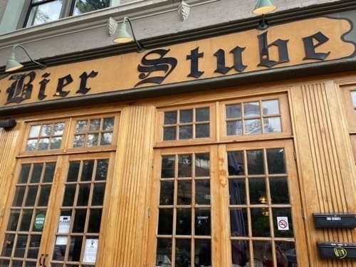
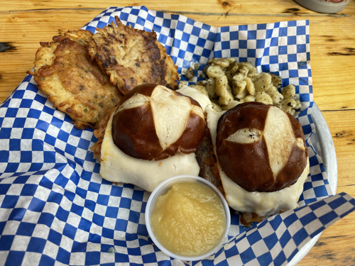
    I got settled at the hotel, did some writing and went to a nearby German place in downtown Moline for dinner. I had some bratwurst sliders with spaetzle and potato pancakes. All in all, a good meal.


    Bier Stube in downtown Moilne Illinois

    Photo of German meal at Bier Stube in downtown Moline Illinois

    A German pop station was playing on the speakers outside. I got to hear a funky 90s remix of “Higher and Higher” and some German news while enjoying my food.

    Moline IL Bier Stube “Higher and Higher” 90s remix.m4a

    Moline IL Bier Stube German news.m4a

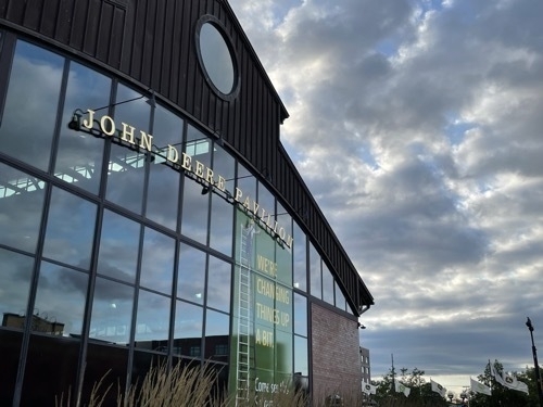
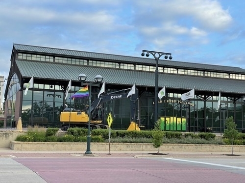
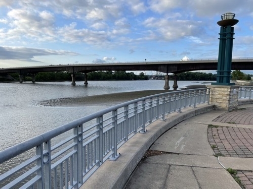
    After dinner I walked down to the Mississippi riverfront linear park and saw the John Deere Pavillion and some Pride flags.

    Photo of John Deere Pavillion in downtown Moline Illinois

    Pride flag in front of John Deere Pavillion in downtown Moline Illinois

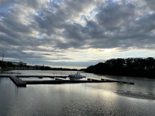
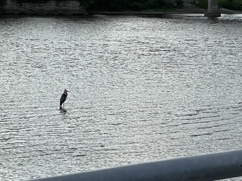
    There was a heron resting on something in the river. The Mississippi is beautiful.

    Photo of Mississippi River as seen from downtown Moline Illinois riverfront park

    Photo of heron resting on something in Mississippi River as seen from downtown riverfront park in Moline Illinois

    Photo of linear riverfront park with bridge over the Mississippi River in downtown Mokine Illinois

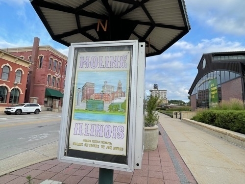
    Public art cityscape poster in downtown Moline Illinois

    Went back to the hotel and went to bed. Undecided on whether to try staying in Eau Claire WI tomorrow night or push through to Hayward WI. We’ll see in the morning.

    → 3:00 PM, Jun 26
  • June 25-Witchita KS-Columbia MO

    Relatively easy drive from Witchita today. Yogurt eaten, car filled up and on the road by 10:30am. Minor panic when the tollway ended and the only choices were lanes for “CASH” or “PASS”. Having neither, I rolled up to the very misleadingly labeled “CASH” kiosk and fortunately was able to pay with my card.

    Stopped in Olathe KS outside of Kansas City for some mediocre BBQ for lunch. I had wanted to go into KC to see the downtown but didn’t have the energy and decided to keep pushing on to Columbia MO. I also decided to pronounce “Missouri” like the locals for the duration of this trip.

    It was kind of a relief to be on divided highways most of the way. Traffic was reasonably light. There was heavy rain for a good part of the way through Missouri, so heavy that it cleared off most of the bugs from the windshield and some from the hood and headlights. Considering that I haven’t had the car washed since well before leaving on this trip, that’s some real rain.

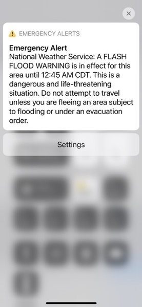
    I had wanted to explore the University of Missouri campus when I got to town but shortly after I arrived and checked into the hotel, it started really coming down. Thunder and lightning and the works. Shortly after that, I got the flash flood warning. So I decided to skip the tourism and grab food at the hotel restaurant.

    BBQ again! Not great but it filled me up. I tried to do some writing while waiting for my food but the speed at which the food came out was an ever-present reminder that BBQ is prepared ahead of time and not smoked to order.

    It rained really hard for the duration of the evening. I half-joked to myself that I hoped the Prius wouldn't float away overnight.

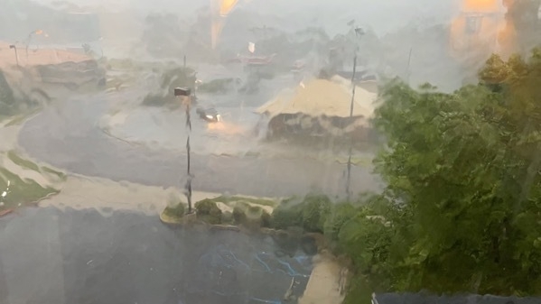
    Heavy rain during thunderstorm in Columbia Missouri near University of Missouri stadium

    Flash flood iPhone warning in Columbia Missouri

    I decided to plug my CPAP into the battery I brought with me and keep things unplugged from the wall just in case.

    → 3:00 PM, Jun 25
  • June 24-Liberal KS-Witchita KS

    In order to get to my next destination, northern Wisconsin, in a timely manner, I’ve decided to suspend my rule of two days in each place I’m staying. This will allow me more time with my parents, who have rented a cabin for us in Hayward WI.

    So I got up, ate two complimentary yogurts and headed out for Witchita. GPS took me down Highway 54, which meant two lanes for the first part of the drive. This was stressful because I drove with the cruise control pegged at the speed limit and there was a lot of truck traffic. They had to pass me from time to time and being large semis, it wasn’t a quick process.

    There were train tracks parallel to the road I was on. I noticed that about every 5 miles or so, there was a tall granary, a rail spur and a town. Like clockwork for at least 50 miles.

    It was interesting and fun to drive through these small communities. Many of the towns, like Liberal, had large signs advertising their many municipal parks. Liberal had at least two skateparks and a water park. In some towns, the sheer number of parks (10? 15?) seemed quite out of proportion to the town’s size.

    I saw lots of billboards advertising industrial agriculture, oil and gas and the occasional oil pump. I didn’t pass any steampunk-looking energy extraction facilities, like the ones we saw in Wyoming this spring along Interstate 80.

    I pulled into a rustic rest area about noon and took a 1/2 hour nap in the AC. Eventually the road turned into a divided highway. That was a much more relaxing drive. I enjoyed watching the grasslands roll by lazily. There were a few ranching-related points of interest along the road but I didn’t stop for any of them. There was a lot of wind along the road and I saw signs warning of gusts, blowing dust and most interestingly, a sign saying to pull over on the right and wait if there was dense smoke because of controlled range burns.

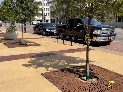
    I finally managed to get to Witchita. I headed downtown to my hotel. Downtown was interesting, at least the few blocks I walked around. It was 100F and super windy so I didn’t get to see much. I saw some wind-proofed street trees, which I took as an indication that downtown was often windy.

    Heavily anchored street trees in downtown Witchita Kansas


    I did get some pretty good BBQ at a place down the street and around the corner. The meal came very quickly. I took my smoked turkey sandwich back to my hotel, ate it, and had a nap.

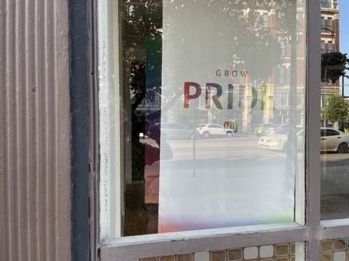
    I got up and did some writing. I looked around for some easy-to-walk-to alternative for dinner. I ended up heading back to the same BBQ place. Along the way, I walked by Witchita’s Pride Festival, a pleasant surprise. I keep on going to the restaurant, this time sitting in the restaurant.

    Corporate sign advertising Pride in storefront window in downtown Witchita Jansas

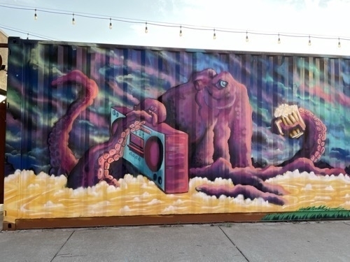
    Street mural with large pink creature against a blue background in downtown Witchita Ksnsas

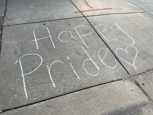
    Sidewalk chalk sign proclaiming Happy Pride in downtown Witchita Kansas

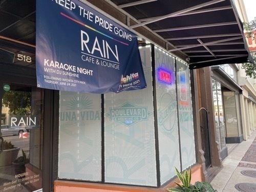
    Sign advertising post-Pride activities at Rain Café and Lounge in downtown Witchita Kansas.


    Wichita Pride.m4a

    After dinner, I went back to the hotel and crashed with a belly full of brisket and green beans and peach cobbler.

    → 3:00 PM, Jun 24
  • June 23-Santa Fe NM-Liberal KS

    I was up in the middle of the night writing on the patio. In spite of this, I felt reasonably well rested up after another night’s sleep in my great hotel bed. I decided to head out from Santa Fe, destination Liberal KS. I think I learned something about Liberal in high school and that there was a story behind its name but couldn’t remember much more than that.

    I tried to go to breakfast at Pasquale’s. Scott and his wife had raved about their breakfast and brunch. Unfortunately they were closed Tuesdays and Wednesdays for breakfast. So I went to another New Mexican cuisine breakfast joint near the hotel. It was delicious. I had an omelet with a chili relleno inside, and beans, and a biscuit. A perfect southwestern meal.

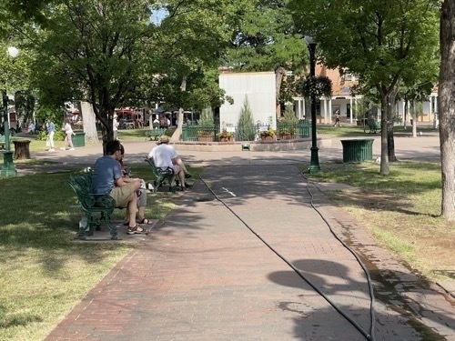
    After breakfast, I went for a walk over to Santa Fe Plaza. Scott’s wife said that she remembered the first time she came to Santa Fe in 1959. Back then, the Plaza was still dirt. Hard to believe seeing it today. It reminded me a lot of Carré St. Louis in Montréal, or something you’d see in New Orleans. Very nice design and clearly well-used by many locals and tourists alike.

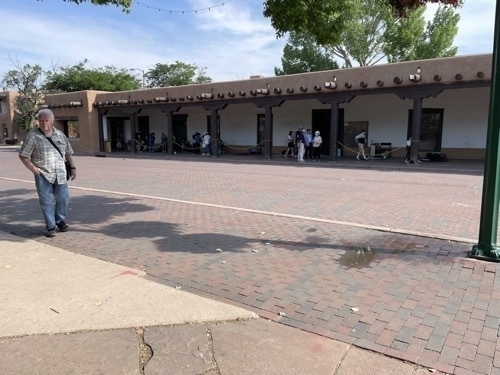
    Man on sidewalk of Santa Fe Plaza in Santa Fe New Mexico

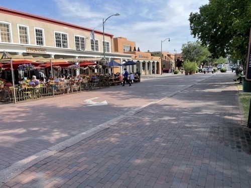
    People at outdoor cafe seating area across the street from Santa Fe Plaza in Sante Fe New Mexico

    People sitting on bench near center of Santa Fe Plaza in Santa Fe New Mexico

    Santa Fe Plaza.m4a

    Saying goodbye to Santa Fe was sad. I like it there. But it was time to leave and move on to the next adventure. So I packed up the car and was on the road by about 10:30am.

    The drive out of that part of New Mexico was, predictably, stunning. Lots of mountainous desert landscapes, twists and turns in the road, and beautiful vistas. As I headed northeast toward the Oklahoma panhandle, the mountains gave way to grasslands.

    I fueled up right at the Oklahoma border at a travel plaza that reeked of fried chicken. I saw lots of Texas license plates there.

    Driving east through the panhandle, I was struck by how gradual the transition was from the high grasslands of New Mexico to the lower plains landscape in Oklahoma. It seemed like one continuous landscape-maybe it was. Also, the panhandle feels very very long, driving west to east. I drove about 2/3 of its length over a span of about 2 hours. It’s beautiful in a desolate, monotonous way.

    I made it to Liberal KS a little later than I would have liked, after a Siri-guided adventure down some country roads. I got real suspicious when she said “Turn right on Road O, then turn right on Mile 40.” Cell service on Mile 40 (a one-lane road) was spotty. However, thanks to Dan being a dedicated interlocutor, I managed to stay connected to a friend the whole time. I got back on to Highway 54 with my faith restored in GPS algorithms. I laughed as I passed a drive-through medical cannabis dispensary in Oklahoma near the Kansas border.

    I heard a lot of Spanish spoken in Liberal, and noticed a lot of Latino business names. I also noticed that there were at least two skateparks that were well-signed. Seeing lots of parks in smaller communities in Kansas would be a theme as I would later learn.

    Since I was in Kansas, I decided to have some mediocre BBQ for dinner. Jenn was nice enough to spend time on the phone with me while I shaved for 45 minutes and then went to the ice cream parlor for dessert. It was wonderful catching up with her.

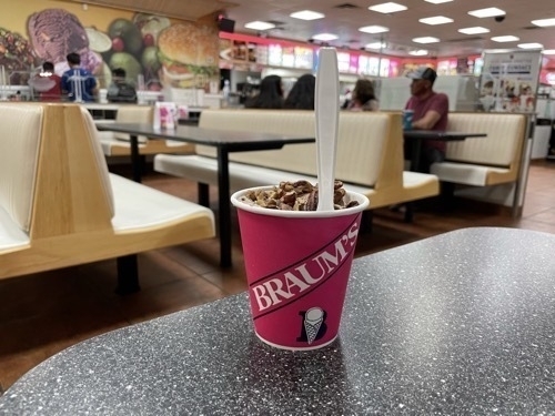
    Ice cream dessert in cup with spoon sticking out of the top at ice cream parlor in Liberal Kansas

    I decided to head for Witchita in the morning and then went to bed.

    → 3:00 PM, Jun 23
  • June 22-Santa Fe NM Day 2

    I had a glorious, full night’s sleep and woke up feeling refreshed and ready for the world. I decided that although Airbnb can be fun and…interesting, it’s worth it to splurge for a nice hotel once in a while. The previous night’s sleep alone was worth its weight in gold.

    I got up, went to Walgreens to get some shaving gear and decided to hit a bakery for breakfast. I drove around a little and found a place that advertised “eggs and matzoh” on their website. When I got there, they were out of matzoh. So I asked for a bagel with lox. They were out of bagels. So I landed on an omelet with lox. Even though eggs are out of character for me, I enjoyed the omelet. I also bought a cherry and green chili filled turnover. I decided to save that for a snack later.

    Cute sign at bakery on door saying

    Bakery patio audio.m4a

    I came back to the hotel to catch up on writing the previous few days’ blog posts. I sat outside on the hotel patio and wrote and watched passers-by. It is a very pleasant patio for that sort of thing.

    Hotel patio.m4a

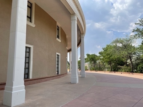
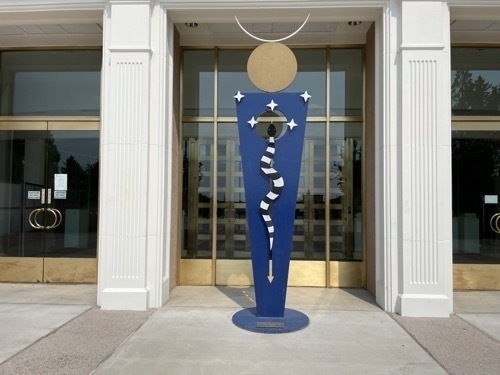
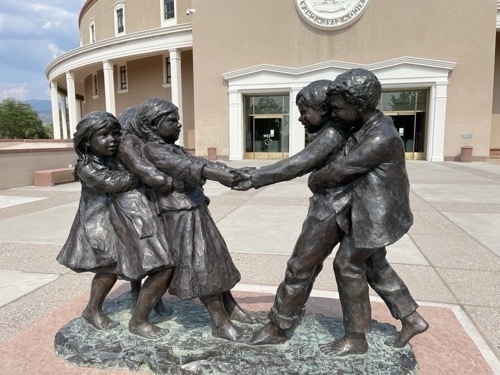
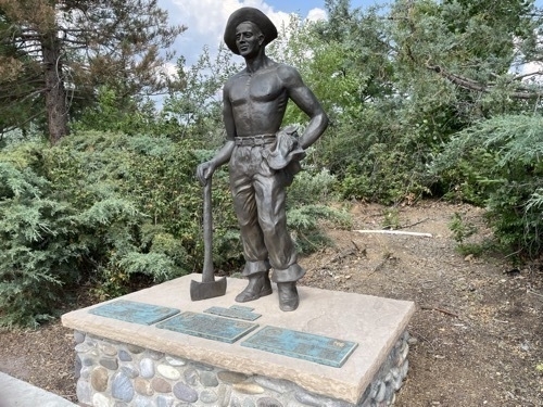
    After a nap, I went for a walk around the Capitol and government buildings complex. It was a very interesting walk. The architecture of the buildings near the Capitol, the Capitol building itself and the public art were all exotic and beautiful to my eye.

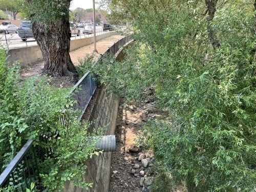
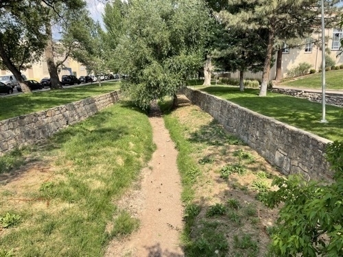
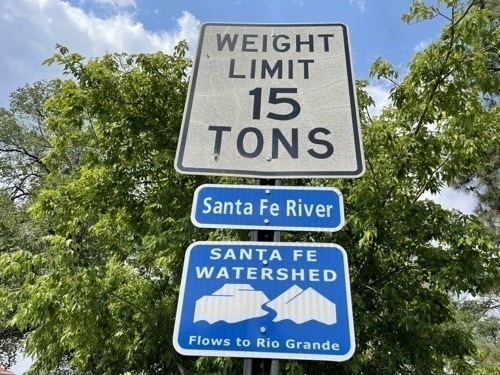
    Dry riverbed of Santa Fe River
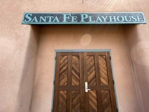
    Door with sign saying

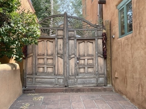
    Elaborate hotel gate

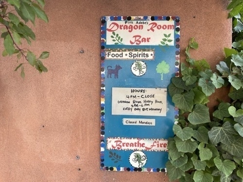
    Sign for Pink Dragon Room bar

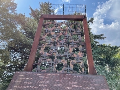
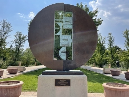
    Public art outside of New Mexico Capitol building

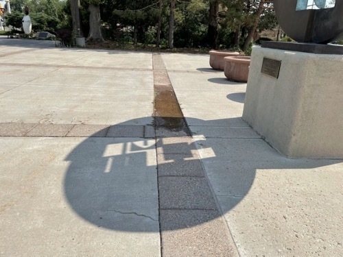
    Circular shadow with inset projected by public art installation outside of New Mexico Capitol building

    Circular sculpture public art outside of New Mexico Capitol building

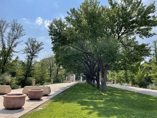
    Row of leafy trees leading to New Mexico Capitol building

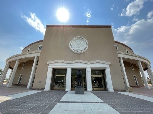
    Entrance to New Mexico Capitol building with State seal in foreground and sun and clouds in background

    Curving sIde view of New Mexico Capitol building with columns

    Blue metal sculpture in front of New Mexico Caputol building

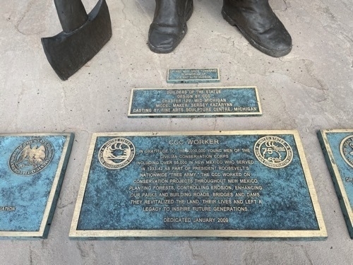
    Public art installation of Civilian Conservation Corps worker resting on hachet outside of New Mexico Capitol building

    Plaque identifying sculpture as depicting Civilian Conservation Corps worker outside of New Mexico Capitol building

    Signs saying
    Photo of dry riverbed of channelized Santa Fe River]Wooden columns lining sidewalk in Downtown Santa Fe New Mexico

    After my walkabout, I went back to the hotel and sat outside again for some more writing. I ate the cherry-chili pastry. It was disappointing.

    I then took a shower and prepared to go to my parents’ friends’ house for dinner. My Dad has an old fishing buddy that recently moved to Santa Fe and he invited me over for dinner with a view. After a stop at Trader Joe’s for some flowers, I headed out into the exurbs of Santa Fe. All of the streets out there were named after animals, like "Paseo del Antilope", except for "Fin de Sentada." ]The street naming scheme seemed kind of twee. The houses and their sites were eye-poppingly gorgeous.

    Scott and his wife were very welcoming and the food they served was delicious. Their house was so beautiful, with its views of the sunset and Los Alamos and mountains in the distance. Scott explained to me how their “jurassic” well water came from 800 feet below ground. He talked with pride about his talent for carpentry. The artful ladle that his wife served the beans that we had for dinner with was one of his creations.

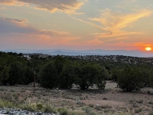
    It was a great meal and a great conversation with great hosts. I was sorry to go but before I did, I got a couple of sunset pictures from their patio. I’m glad I took them-if for no other reason than to document the evening.

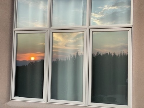
    Sunset reflected in window of house outside of Santa Fe New Mexico

    Sunset outside with Los Alamos New Mexico in the distant background

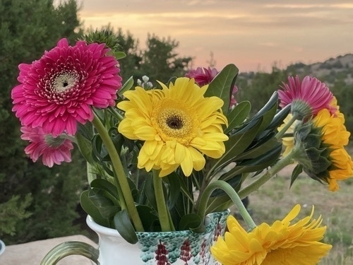
    Vase of flowers with sunset in the distance outside of Santa Fe New Mexico

    Crickets.m4a

    By the time I got back to my hotel it was dark out. On my way in the door, I asked the hotel front desk if they had room for me for one more night. I did not want to leave Santa Fe just yet. I decided to figure out if I would stay in the morning.

    → 3:00 PM, Jun 22
  • June 21-Santa Fe NM Day 1

    I slept OK last night, not great but mostly through the night. In the morning, I got up around 8, had a little breakfast, putzed around, did some more writing and packed up the car.

    Before I left, David gave me a check because apparently PayPal had charged me twice for the same reservation. I told him about my AirBnb refund situation and how I was still waiting on a response from them. I thanked him for his honesty and for making things right. I was still waiting for AirBnB to respond to my request for a refund. I didn’t want to deposit the check until I heard back from Airbnb because it wasn’t David’s fault or problem. Anyway, we agree that I would deposit the check later that day, after I tried again to get Airbnb to respond to my inquiries.

    I left for Santa Fe around 11:15am. There are at least two roads between Santa Fe and Taos, the High Road and the Low Road. I read that the Low Road followed a valley floor through farmland. I decided to take the High Road because it sounded like there might be more views from a perspective above part of the landscape.

    I was not disappointed. The High Road had some spectacular views.

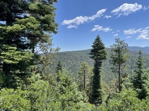
    View of forested mountains along High Road from Taos to Santa Fe outside of Taso New Mexico

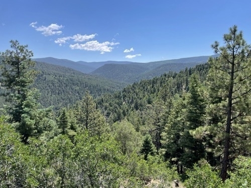
    View from scenic overlook along the High Road from Taos to Santa Fe outside of Taos New Mexico

    I also got some good ambient sound at a viewpoint along Highway 515.

    Hwy 515 NM scenic overlook.m4a

    I pulled over and took a short cat nap on Highway 76, and got a few good pictures along that road.

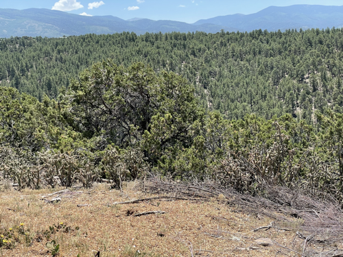
    Expansive view of desert forest near Truchas New Mexico

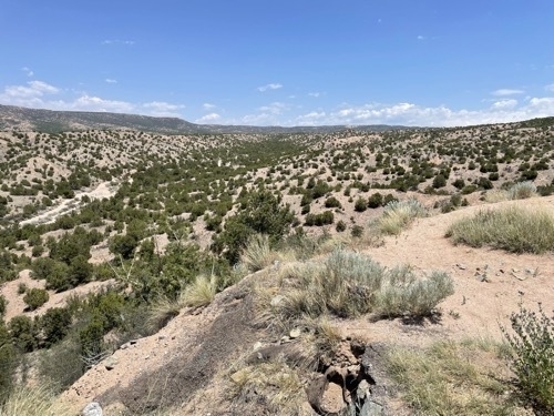
    View of desert with scrub vegetation near Chimayo New Mexico

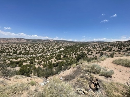
    VIew of vast desert landscape with scrub vegetation near Chimayo New Mexico

    It is very hard to convey the scale and beauty of the New Mexican landscapes from these pictures, which is frustrating to me. I don’t know how to solve that problem with my gear and skill level. I love landscape photography. It can be so peaceful and meditative, and challenging. I’m doing my best to muddle through.

    Again driving through the small communities I was struck by each one having a very small post office. Part of the High Road goes through some towns that have artist’s studios and galleries. I did not stop for any of those but there were many along the way, especially as I got closer to Santa Fe.

    Once I got onto Highway 295, the pace picked up. It’s a much larger road than the rest of the way from Taos. There was also a lot more traffic. I was going the speed limit and passed some cars with Mexican license plates who were going much slower.

    Santa Fe is bigger than I expected geographically and sprawl-wise. It is an interesting urban environment. It reminds me a little of Montreal the way it has an Old Town with government functions and touristy areas that is surrounded by more contemporary North American urban landscapes. It seems to be largely a one- to two-story city, with a lot of buildings in the styles that are typical of this region.

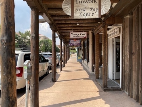
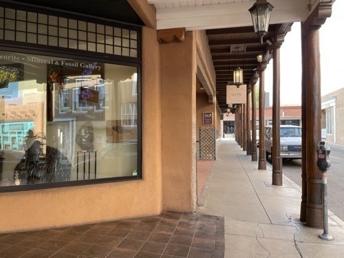
    View down sidewalk with posts in downtown Santa Fe New Mexico

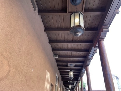
    View of wooden posts supporting upper story along sidewalk in downtown Santa Fe New Mexico

    I am planning on visiting the Capitol and nearby Plaza.

    On David’s recommendation, I got a reservation for two days at a nice hotel right downtown. I was starving when I got to town and tried to go to the New Mexican place nearby that the hotel staffer and David both recommended but they were booked up until 9:30pm. So I made a reservation for one for 9:30pm and went to the sushi place down the block. It was OK-better than anticipated and reasonably quick even though they were moderately busy and there were only two people on staff who were doing All The Things including cooking, preparing the sushi and serving tables.

    The hotel was nice. I settled in and took a nap. When I got up, I did a couple hours worth of writing, took another nap, and went to dinner at 9:30pm

    Dinner was delicious. I had a tamale and a bison burger with some salad. They were both fantastic. By the time I finished up and walked the 50 feet back to my hotel, it was 10:30pm and I crashed.

    → 4:00 PM, Jun 21
  • June 20-Taos NM Day 2

    I slept ok for a few hours the night before but got up around 1:30am and worked on getting this here blog written and up and running. Around 4:30am, I had all the writing done and I got the newsletter out. It felt great.

    I went back to bed until 6:30 and tried to go to the Bearclaw Bakery in Taos at 7am. Apparently they open an hour later on Sundays. So I tooled around and came back shortly after 8am. I got inside just before the line was out the door. I had wanted to sit outside but the small patio was already full. I had a blue corn pancake with blueberry compote, a lemon-cream cheese croissant, and a cup of decaf. My plan had been to camp out and write, but the place was so busy that I felt bad for soaking up space. I ended up leaving after about 45 minutes.

    I decided to try to see Taos Pueblo but there was a sign that said it was closed. Even thought the gate was open, I opted to respect the sign and I turned around. While I was doing that, a car passed me and went in.

    I went back to David’s place and took a nap. Then I got up and decided to drive the Enchanted Circle.

    The Enchanted Circle is a tourist loop that goes through several small communities with stops along the way for scenic and other cultural resources. It is very beautiful, like the rest of the region around Taos.

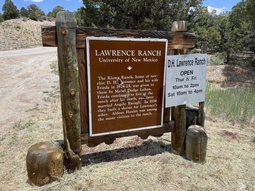
    I stopped to take some pictures along the way. The University of New Mexico now owns D. H. Lawrence’s ranch.

    Sign announcing the D. H. Lawrence Ranch outside of Taos New Mexico

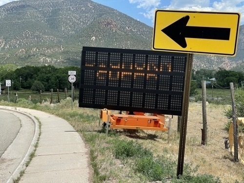
    Here is a sign announcing that there are bighorn sheep in the road for the next 9 miles. Hard to read because my phone’s camera doesn’t do well with LED reader board signs.

    LED reader sign saying

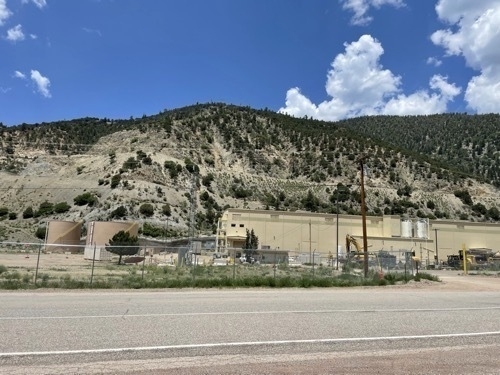
    The mountains around the region are quite beautiful. They are occasionally juxtaposed with industrial development.

    Industrial development in front of forested mountain along Enchanted Circle in New Mexico

    I got some ambient sound along the Enchanted Circle.

    Eagle Nest NM.m4a

    A goodly part of the Enchanted Circle is part of the Kit Carson National Forest. The landscape varies with respect to tree density.

    Trees and mountains in Kit Carson National Forest along Enchanted Circle in New Mexico

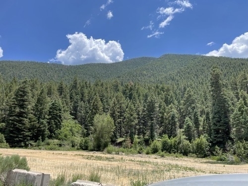
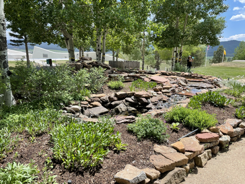
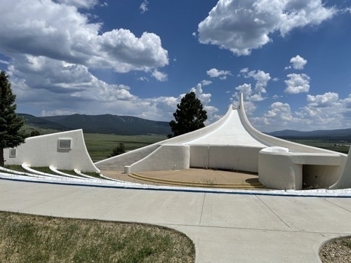
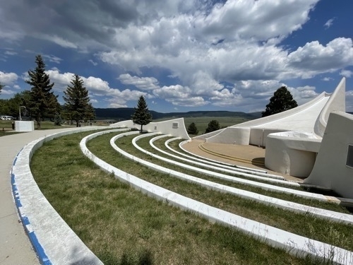
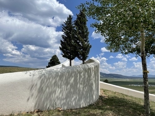
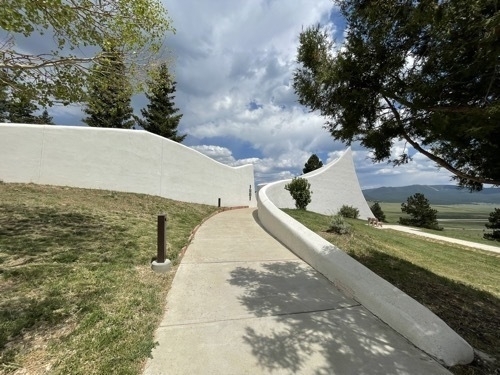
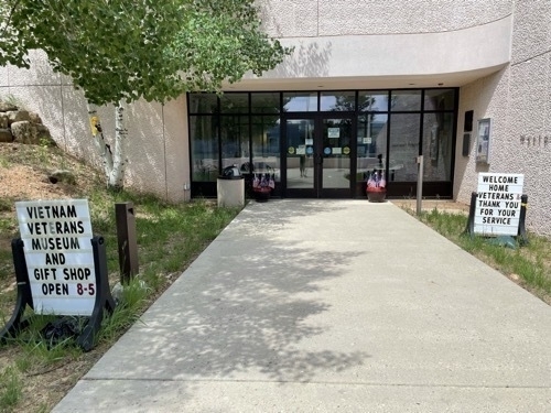
    There is a stunning Vietnam Veterans Memorial near Cimarron, about 2/3 of the way through the loop. I took a lot of pictures because I was fascinated by the architecture and landscape architecture. I was reminded of the Vietnam War Memorial in Washington, DC even though they are almost polar opposites in terms of design and physical context. Here is what it sounded like.

    Vietnam Veterans Memorial NM.m4a


    Landscaped water feature in Vietnam Veterans Memorial in Cimarron New Mexico

    Ampitheater at Vietnam Veterans Memorial in Cimarron New Mexico

    Amphitheater seating at Vietnam Veterans Memorial in Cimarron New Mexico

    White amphitheater walls with trees and grassy areas at Vietnam Veterans Memorial in Cimarron New Mexico

    White amphitheater walls with trees and grassy areas at Vietnam Veterans Memorial in Cimarron New Mexico

    Entrance to gift shop at Vietnam Veterans Memorial in Cimarron New Mexico

     When I got back to the man cave, David was already firing up the BBQ and friends were there. I met a few of his friends, who were just like David-warm, welcoming and friendly. We talked for a while and they were also curious about Portland. It’s interesting how Portland’s reputation in far away places was, for these people at least, all about last summer’s protests and the ongoing vandalism. I did my best to contextualize the situation and explain that most of the city was peaceful and working on other problems like homelessness, poverty and housing affordability. They seemed to understand and accept what I was saying. Again, I appreciated the respectful conversation.

    The food was great. Ribs, corn on the cob, homemade potato salad-it was all delicious. At some point I overheated, excused myself and went to my room. It was so hot out, I needed some powerful AC. When I got up, the party was over. I did some writing and went back to bed.

    → 4:00 PM, Jun 20
  • June 19-Taos NM Day 1

    Another fitful night of sleep. I had the car packed up and was on the road by 10am.

    On the way to Taos, I saw the turn off for the Chaco Culture National Historical Park and considered taking it but decided not to because I couldn’t tell if the roads were paved the whole way there, and how long it might take. It was also really hot out and I didn’t want a repeat of the previous visit to a National Monument. So I kept on driving, which I sort of regret because I’ve heard it’s amazing.

    The drive from Aztec to Taos was eye-scorchingly beautiful. I went on small state highways through many tiny towns and settlements. The main consistent landmarks I noticed were post offices. There were a lot more than I would have expected. The post offices were also tiny.

    The landscapes varied, from a dusty, sandy beige desert with random rock outcroppings and the occasional tree to scenes that looked like they could have been in the non-Mandalorian parts of Utah, except they were also beige and green too instead of orange. There were some red mountain sides and lots of rocks. As I got closer to Taos, there was more water visible, in creeks and streams as well as reservoirs stocked with fish.

    Joshua and Jonathan kept me company on the phone when I had service. Joshua and I discussed our plans to meet up in St. Louis and drive to Chicago together. Jonathan found me some places to eat in Taos.

    When I got closer to Taos, I called my host and asked if I could arrive a little early, around 2pm instead of 4pm. He was very accommodating-a theme with David.

    I had trouble finding the place because AirBnB has the wrong address on file. David had previously tried to fix this but has had no luck. I called him when I drove past a bunch of nondescript driveways with gates and fences that all looked the same to my city slicker eyes. He told me to turn around and drive back and look for a large black truck nosing out from one of the driveways. Again, so helpful!

    When I finally got to the place, David explained with a lot of pride how he built his man cave, and welcomed me to use any of it. His main rules were, “No parties-unless I’m invited!” and “Respect my property and I’ll respect yours.” Very reasonable. The rental had two “rooms”, one was a small bedroom that had a fridge and coffee maker and a basket full of goodies, and a POWERFUL WINDOW AC UNIT THAT WAS ALREADY ON AND THE PLACE WAS ICY COLD, which I greatly appreciated after the last place.

    I got all of my stuff into the bedroom, then David showed me the rest of the man cave. It had a weightlifting bench, a bar, a turntable with Judas Priest LPs next to it and a bunch of other man-cave-y type stuff. There was a shower and separate WC that were spotless and looked to be quite recently installed. He invited me to use all of it, and to call or text him if I had any questions or needs.

    David’s friend Robin was over visiting when I arrived. The three of us spent some time talking. The conversation turned to politics, with me being on the far left, Robin being center right and David being to the right of Robin. I appreciated their perspectives and I was reminded how different the realities of the various parts of our country can be.

    They asked me about life in Portland and I talked about alternatives to traditional public safety models like Portland Street Response. They asked me about last summer’s protest activities and I explained that I had been protesting along with other BLM supporters. They listened respectfully and we talked about my work. Overall it was a good conversation and I appreciated that they heard me out as we sought common ground.

    I thanked David for being so flexible and hospitable and told him I needed to eat some food and then take a nap. He left me to it.

    I drove into Taos proper and checked out one of the places that Jonathan found. It was decent, simple New Mexican cuisine and I devoured it. The patio where I sat was very comfortable. There was an umbrella at my table. This was A Good Thing because when the sun wasn’t beating down mercilessly, there were thundershowers.

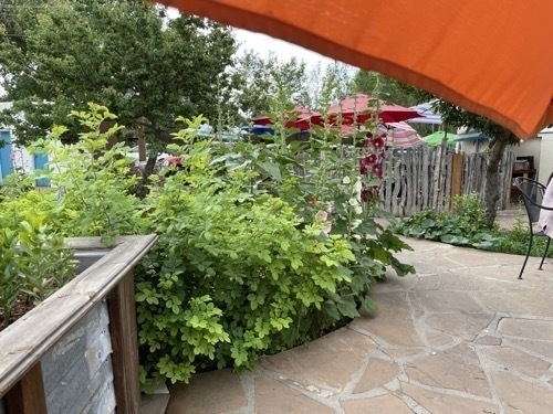
    View of La Cueva patio in Taos New Mexico

    La Cueva Cafe Taos NM.m4a

    On my way back to David’s place, I noticed a lot of bakeries. This was exciting because of how much I love bakeries. I stopped at the grocery store and got mac and cheese, cereal, cottage cheese, chocolate oat milk and yogurt for dinner and breakfast for the next two days. The mac and cheese was Juliette’s recommendation. Thank you Juliette!

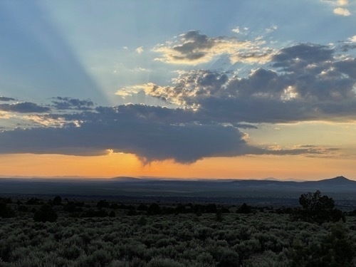
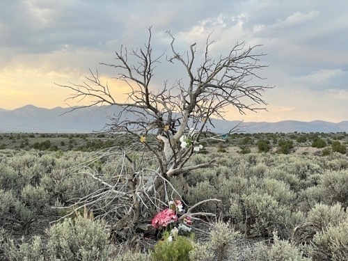
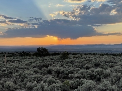
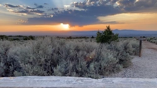
    Before sunset, I asked David if there was a good vantage point to take pictures from. He told me about a location about 7 miles out of town. It did not disappoint. I got some photos and some time lapses. As usual, you had to be there, but here is some of what I took anyway.

    View of orange sunset behind little fluffy clouds outside of Taso New Mexico

    View of tree decorated with colorful objects outside of Taos New Mexico

    View of sunset with desert vegetation in foreground outside of Taso New Mexico

    Time lapse video of sunset outside of Taos New Mexico

    → 4:00 PM, Jun 19
  • June 18-Aztec NM Day 2

    I slept in as late as I could because the house had cooled off the night before, and I had slept very poorly most of the night. Aztec Ruins National Monument conveniently turned out to be about 1/4 mile down the street from where I was staying. I drove even though the distance was walkable because it was so hot and sunny out.

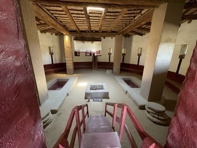
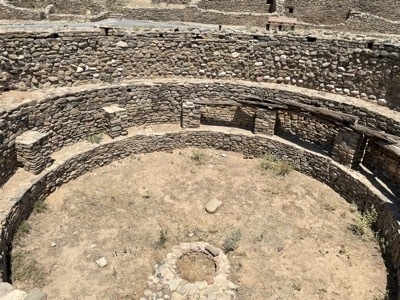
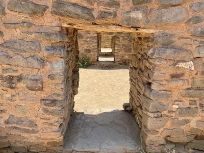
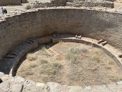
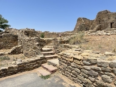
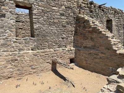
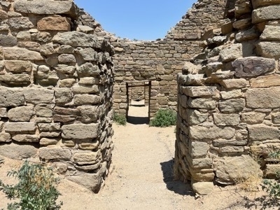
    The National Monument is small compared to the National Parks I’ve been visiting-maybe 5 or 6 acres total. It’s less like a park and more like a walkable tour of a culturally significant landscape feature. The Monument has a path that leads you through cultural artifacts that looked to my eyes similar to what I saw at Mesa Verde NP. There were water collection and storage facilities, and a covered, semi-underground area that had intricate masonry work.

    Downward-facing stairs at entrance to underground strcuture at Aztec Ruins National Monumnet in Aztec New Mexico

    Ancient indigenous water facility at Aztec Ruins National Monumnet in Aztec New Mexico

    Corridor through structure at Aztec Ruins National Monumnet in Aztec New Mexico

    Ancient Indigenous engineered water facility with people in upper right hand corner for scale at Aztec Ruins National Monument in Aztec New Mexico

    Stairway and walls at Aztec Ruins National Monumnet in Aztec New Mexico

    Walls with windows at Aztec Ruins National Monument in Aztec New Mexico

    Corridor leading through series of walls at Aztec Ruins National Monument in Aztec New Mexico


    It was so hot out that I quickly walked through the area without really stopping to examine each feature and structure. I felt guilty for speeding through it but it was sweltering out and there was very little shade along the path.

    In the first recording, you can hear two members of a Friends of Aztec National Monument group discussing the handmade wares they sell to support the Monument to some tourists who were looking at them.

    Aztec National Monument NM.m4a

    In the second recording, you can hear me entering the underground structure.

    Aztec Ruins National Monument.m4a

    In both recordings, you can hear me breathing heavily due to the elevation and heat. And the fact that I’m a total mouthbreather.

    I went to Safeway and bought some yogurt, and spent the rest of the day at the AirBnB trying unsuccessfully to stay cool. At first I tried to take a nap, but after about noon it got to be too hot for that. I camped out in the living room next to the window unit but it just couldn’t keep up. The temperature slowly rose throughout the afternoon. I did get some work done on the behind the scenes stuff for the blog and email address for this trip done so that was good. Diana and I talked and she inspired me by staying she wanted to eat cheese and appetizers for dinner. I ended up eating yogurt for dinner as well.

    I decided to reserve an AirBnb in Taos so I found one that had excellent reviews. It sounded intriguing-a bedroom in a man cave? How novel! The reviews all mentioned that the host was very hospitable and helpful.

    Shortly after I reserved it, I got a panicked call and then a message via the AirBnb app from the host. I was on the phone when he called so I called him back later. His message said “Thanks for reserving! I need to spiff things up a little, when do you think you will be here tonight?” I then realized that I had reserved the place for that same night for three nights. Whoops. I messaged him right back and thanked him for helping me realize this and explained the mistake I had made.

    In retrospect I should have just driven to his place in Taos that, as it turned out, had powerful AC, and just thrown away the second night in Aztec. Instead I asked him if the place was available Sat-Mon instead of Fri-Mon. He said it was and encouraged me to change or cancel the reservation for the right nights.

    So I went into the app and tried to change it. The app, which lately has been really buggy, wouldn’t let me change the start date. Long story short, I ended up canceling and rebooking and only got a partial refund for Friday night and didn’t hear back from AirBnB that day about my request for a full refund.

    I called my Taos host back to confirm the changes. He asked if I would be comfortable if he had a BBQ in the man cave next to my bedroom on Sunday night to which I was invited. I said sure-that sounded great-but I left the door open to not attending depending on my energy level as I had been sleeping very poorly or not at all the last few nights. He said I was welcome either way.

    I spent the rest of the evening working on getting the blog up and running and trying to sleep with weak AC. One task was easier than the other.

    → 4:00 PM, Jun 18
  • June 17-Aztec NM Day 1

    Got up around 9 with the intent of eating breakfast, taking a nap and checking out right at 11. After eating breakfast, I took a shower and decided to load up the car and go into town to catch up on some writing from the last few days. I’m headed to Aztec NM later today where I will stay for two days while I visit Aztec Ruins National Monument.

    I ended up at Absolutely Bakery and Cafe in Mancos. Lots of Pride on display , which I appreciated. Had a decent quiche, and a great iced tea, and sat and did some writing. I also worked on setting up the domain name, blog and newsletter for this trip. I settled on epicroadtrip.live for a domain name. I hit a couple of roadblocks getting things set up, mostly with getting email set up with the new domain name.

    On my way to Aztec NM, Siri tried to take me down some unpaved county roads but I decided to stick to the paved state highways and streets.

    The main reason I decided to stay in Aztec is to see the intriguingly named Aztec Ruins National Monument. Just on the north side of town, I’m staying within a 10 minute drive of the Monument. I’m very curious to learn how it got its name.

    Aztec has a nice Main Street. I got here early so I went to a pizza brewpub and ordered a pizza and camped out for a while, waiting until my AirBnb reservation started at 4pm.

    
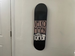
This AirBnb has weak AC and a fan that turns too slowly. There is no AC (!) or fan (!!) in the bedroom, so I might sleep in the living room tonight. hopefully I will survive the next two nights and not melt into an evaporating puddle. This rental has some shabby-chic art which is cute, including a skateboard deck that says “Velkommen” on it. Swedish, maybe?

    Photo of skateboard deck with design of house and the text

    Went to an old-school Mexican restaurant in an otherwise dead strip mall in Farmington NM, the next major town ove.. I had tamales and they were delicious. I forgot how huge the beverage cups can be in the Southwest. I ordered a water and it was at least 24 oz.

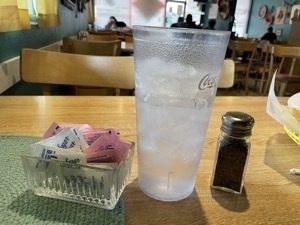
    Photo of gigantic glass of water next to a pepper shaker and sweetener dish to show scale. The water cup towers over the two other objects. Taken at Francisca's Mexican Restaurant in Farmington New Mesico.

    When it was time to pay, I realized I didn’t know where my wallet was. I felt terrible and asked the host if I could drive back to Aztec and try to find it and then come back before they closed and pay. It was a 20 minute drive each way, it was about 7:30pm, and I didn’t know if I would find the wallet. The nice, very gracious gentleman who I wasn’t able to pay said “Sure, you’re on your honor but I trust you.” I was freaking out-what if it fell out of my pocket? It had my ID, health insurance card, two credit cards and two debit cards.'

    When I got back to the rental, my wallet was sitting on top of the dresser next to the bathroom. D’oh. I called the restaurant and asked if I could pay over the phone with a card or if I should come in to pay. The gentleman was kind enough to take my payment over the phone. It was only later that I realized that he didn’t ask for a tip. D’oh.

    → 4:00 PM, Jun 17
  • June 16-Mancos CO Day 2

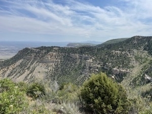
    Went to bed early last night and slept well. Spent the morning and early afternoon in Mesa Verde NP. Saw some neat ruins, but didn’t do the whole park. It’s a big park. Photo of tall mesa plateau with steeply sloping sides and fluffy clouds in the background

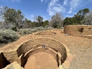
    Large, well-preserved circular indigenous water collection faciltiies made out of ancient brock

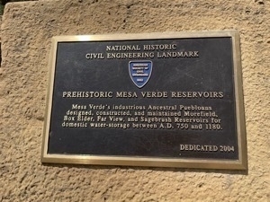
    Placard from American Society of Civil Engineers delcaring the prehistoric water collection facilities built by Indigenous peoples of the region. Placard reads

    Mesa Verde National Park CO Geologic Overlook 2.m4a

    Mesa Verde National Park Far View Sites.m4a

    Got back to the place where I am staying and took a nap. Then, went to the local cidery here in Mancos and had some unfiltered, non-alcoholic apple cider. It was delicious. Met two nice people and their cute puppy who I sat next to in the cidery’s outdoor patio. It is still hot but about 10 degrees cooler than where I was in UT.

    Went to Durango CO for a late lunch. Tried going to a brewery that Maps said was open, but actually, they were closed for two days for improvements. So I went to Animas Brewing, which is right by the Animas River which runs through Durango. They had cheese curds! And pasties! I wondered if the owners were Midwesterners. Two two tourist trains went by carrying lots of people who waved at those of us sitting on the patio. The trains were LOUD. The tracks are right next to the brewery.

    Drove back to Mancos after eating and hit the first rain of the trip. It washed off the car which was good. When I got back to the rental, I had good intentions to build the blog I’m going to use to post media of my progress on this trip but I was too tired. I ended up going to bed super early.

    → 4:00 PM, Jun 16
  • June 15-Mancos CO Day 1

    It has been very hot. There is a drought and a heat wave in this part of the country right now. I’m doing my best to stay hydrated.

    I decided a couple of things today:
    - I’m not going to Big Bend or anywhere in Texas
    - I’m doing less driving between destinations, hopefully no more than 3 hours per travel day.
    - I’m not staying anywhere for less than 2 nights

    It’s too hot to go to Big Bend, and the parks are too far from the nearest towns where I could stay. I was considering Marfa as a place to stay but it’s 2.5 hours from Marfa to Big Bend State Park. The National Park is closer but I’m not interested in driving more than 1/2 hour or so from where I’m staying. I also am concerned about breaking down or having another kind of car problem when commuting to and from the park across the west Texas landscape.

    Today I drove from Green River UT to Mesa Verde National Park near Mancos CO. It took a hour longer than I thought it would, I was exhausted when I got to the park, I didn’t get to see much, and I had all of the gear and food I brought in the hot sun without AC when the car was parked.

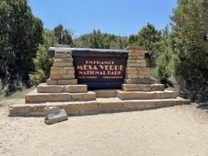
    Sign at entrance to Mesa Verde National Park

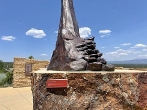
    Photo of large bronze sculpture placed on 4 foot high pediment outside of entrance to Mesa Verde National Park visitors center

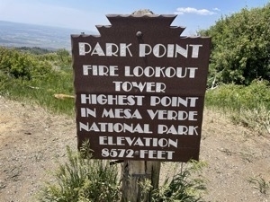
    I went to the highest peak in the park, looked around, recorded some sound, then got back in the car on and took a quick cat nap with the AC on.

    Mesa Verde National Park.m4a

    Sign at Park Point in Mesa Verde National Park in Colorado. SIgn reads

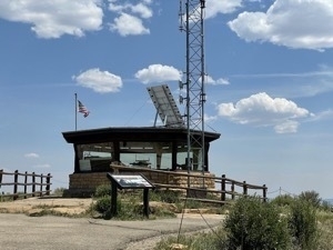
    Fire lookout tower atop Park Point in Mesa Verde National Park near Mancos Colorado.

    I contacted my AirBnB host and asked if i could check in an hour early, and if I could extend my reservation by a day for 2 nights total. They were kindly able to accommodate me with both requests. By the time I drove out of the park, went to the store to get some food for breakfast, and got the AirBnb, I was able to check in. Thankfully the AirBnB has good AC and a large floor fan.

    I need to be more mindful of my time budget and not push it on my way to new places. So, a minimum of 2 nights for the rest of the trip. It also gives me a chance to catch up on writing, processing photos and audio, and napping.

    Mancos is a nice town with a strong Western vibe. It has a couple of restaurants, a makers district, a cidery and a few cafes. People have been friendly and chatty.

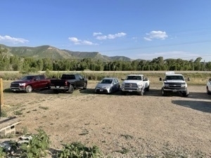
    Got not-great dinner to go at a local brewpub and went back to the place I am staying. Parked the Prius in the middle of a bunch of trucks in the brewpub parking lot.

    Silver Prius V surrounded by enormous pickup trucks in gravel parking lot.

    Talked with Joshua to get some ideas for southern NM. There is a large land art installation near White Sands that I might check out. 

    → 4:00 PM, Jun 15
  • June 14-Green River UT Day 3

    June 14th
    My month away from work officially starts today. I’m due back on Tuesday, July 13.

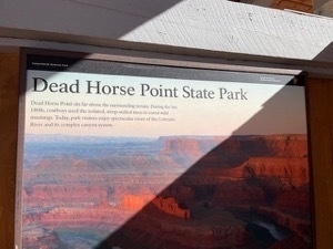
    Got up at 7am for breakfast after barely sleeping most of the night again, then headed out for a sleepy but beautiful drive to Dead Horse Point State Park. Dead Horse Point SP is next to Canyonlands National Park. Legend has it that 19th century cowboys used the steep canyon walls to corral wild mustangs, some of whom died during the process, hence the name.

    Green River UT River Rock Inn B&B Breakfast.m4a

    Wayside interpretive sign for Dead Horse Point State Park with sunbeaum illuminating the title text that says Dead Horse Point State Park

    Photo of sign announcing entrance to Dead Horse Point State Park near Canyonlands National Park in Utah with outline of horse on the sign.


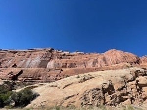
    The drive up to the two adjacent parks is stunning, with lots of views of intricately-structured rock faces.

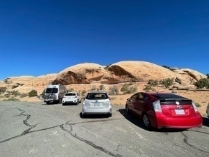
    I decided to try to park near other Priuses whenever I can during this trip because they have been so rare during this trip so far.

    Our silver Prius V parked next to a red second generation Prius with Navajo Nation license plate as seen from the rear of both cars in a parking lot with a deep blue sky above and strange dome-like rock formations in the background


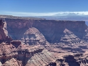
    At the state park, there were breathtaking views of the Colorado River and its canyons, including distant potash pools with unreal colors that looked like they had been photoshopped with a comic book art filter.

    Didn’t get that many good pictures because the unprotected edges of the trails triggered my fear of heights and falling. The sun was so bright again that I couldn’t see the camera  screens. Some of the pictures came out ok but much like the Grand Canyon, it was hard to capture the scale of the place.


    Photo of three striated peaks above Colorado River as seen from Dead Horse Point State Park near Canyonlands National Park in Utah

    Recorded some ambient sound at the park’s visitors center. There was an interesting sounding high pitched whine coming from an insect or bird.

    Dead Horse Point State Park UT visitors center 2.m4a

    Overall pretty happy with the sound recordings.

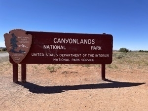
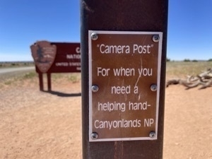
    After Dead Horse Point SP, I tried to go to Canyonlands NP but the line of cars stretched around a corner that was at least 1/4 mile away and was barely moving. After taking a picture of the park’s entry sign and its nearby camera perch, and doing the same for a family that was staying at the same hotel, I decided to skip visiting the park.

    SIgn for Canyonlands National Park in Utah

    SIgn announcing post with small platform to be used for selfies in front of the main sign for for Canyonlands National Park. Sign says

    I regret not being able to see the park but if I had to do it over, I probably would have made the same decision.

    Thought about going to Moab for lunch but was so exhausted from the heat and lack of sleep that I came back to Green River. Had a good conversation with Shaun on the way back. We started to discuss whether or not I will go to visit him and his family in Rochester New York during this trip. I would like to try to make that happen but it would add another 3000 miles to the trip. That is a lot of miles if I’m only driving 3-4 hours a day.

    I decided to try the local supermarket for lunch supplies, which was…not great. I bought a small container of yogurt, a tub of cream cheese and some Goldfish crackers and then came back to the motel to have lunch and nap.

    Got up around 6pm after napping hard for about 4 hours. The nap was hugely helpful in terms of catching me up on some much needed sleep. I woke up feeling well rested and ordered dinner from the Tamarisk. Came back to the hotel and ate dinner, then sat outside for a bit in the heat and did some research on NPs in nearby states. Talked with friend Stewart who consults for the National Parks Service to get some advice on where to go in New Mexico and Texas. He recommended a bunch of parks in New Mexico that I have been hearing about from other friends and family.

    I need to figure out where to stay in NM so I can get to these parks. I also need to figure out my time and money budgets so I can determine where to go and how long to stay.

    I learned from Stewart that Big Bend NP is often closed for parts of the summer due to excessive heat. On his advice I checked the website and it seems that most parts of the park are open as of today.

    I am having a moral dilemma: Stay in Marfa, TX, commute to the parks and contribute to the Texan economy at a time when their legislature is doing some horrible things to the LGBTQ+ community (during Pride Month no less), or boycott the state and Big Bend parks.

    I desperately want to return to Big Bend. My first visit was 24 years ago and I remember it fondly. However, the commute from Marfa to the NP is at least 1.5 hours each way, 3 hours of commuting across that part of west Texas is on the longer side of what I am willing to tolerate.

    Big Bend Ranch State Park is even farther from Marfa, an hour longer each way than the NP. Apple Maps is also saying that the trip to the SP “may include unpaved roads”. In my experience, that usually means “does include unpaved roads”. I am not excited about putting the 2WD Prius through that. The last thing I need is to break my car in a desolate part of the Southwest.

    I would like to drive from El Paso to Houston to see a few parts of the state that I haven’t been to before, If I decide to do that drive, I am undecided on returning to Austin, but am leaning towards “no”. 

    → 4:00 PM, Jun 14
  • June 13-Green River UT Day 2

    Still up at 2:36am so spent an hour catching up on writing this travelogue. Slept terribly. Got up at 7:30am, went to breakfast at 8. Breakfast was simple and delicious. Here is what it sounded like:

    Green River UT River Rock Inn B&B Patio.m4a

    Left for Arches around 8:45pm, got there at about 9:20pm. 78F when I left and 84F upon arrival. The park was full and they were turning people away. First drowsy drive of the trip. I went home and took a nap. Had lunch at the Tamarisk again which was delicious again. I went back to the motel and unsuccessfully tried to nap between 2:30pm and 4pm.

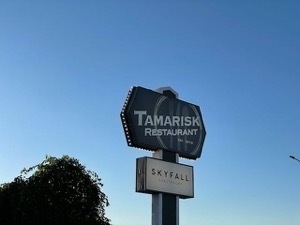
    Talll roadside sign for Tamarisk Restauarant in Green River Utah

    Green River UT Tamarisk Restaurant.m4a

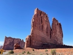
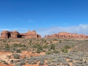
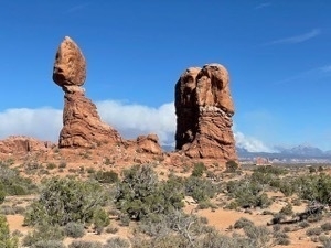
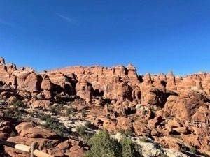
    Got up at 3:45pm, went back to Arches and got in this time. Spent about 2 hours driving around and taking pictures. The sun was super intense and harsh so I had trouble seeing my camera screens. I tried my best to get some good images anyway. I got a few. I couldn’t really do any walking around because it was too hot so I didn’t see that many actual arches, but I did see some amazing rock formations. If I had to describe Arches as a mash-up, I would say it’s a combination of the Painted Hills, the Badlands, the Grand Canyon and a set from the Mandalorian. It is other-worldly.

    Wide angle view of giant orange hillside with striated rocks and deep blue sky in Arches National Park near Moab UtahTall spire-like orange rock structure jutting towas a deep blue skyGrey-green ssgrbtush in the foreground with large orange rock formations in the distant backgroundHillside with repeating orange rock structures that look like many people's heads against a deep blue cloudless sky

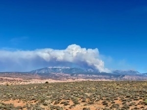
    There was also what looked to be a massive fire in the mountains to the west of the park. It was so enormous that is was hard to capture the scale of it. Enormous.

    Photo of enormous wildfire burining in the distant moutnains as seen from Arches National Park near Moab Utah

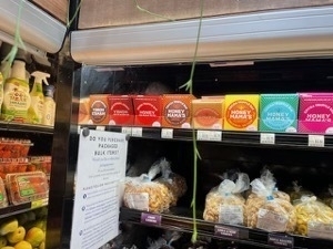
    It was 109F at 6:30pm at Arches so I decided to pack it in and go to Moab to get some food. I hit the co-op which was appropriately groovy and full of hippy-type people. I saw a couple of Oregon products there, including chocolate and cheese.

    On my way back from Moab, I decided to call my friend who consults for the National Parks Service to ask his ideas for which parks I should hit while on this vision quest. Left a voicemail. Dad also sent his suggestions for sites with indigenous peoples’ dwellings and petroglyphs accompanied by some of his and Mom’s photos.

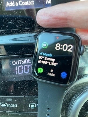
    Got back to the motel around 8pm where it was only 100F at 8pm.

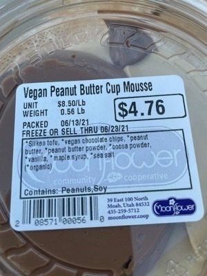
    xFingers  hlding watch face in foreground showing 8:02pm with car temperature gauge in background showing 100FVegan peanut butter and chocolate mousse from food co-op in Moab Utah
    Ate some of the food I bought at the Moab co-op. Now it’s time for bed. Breakfast is at 7am tomorrow. I’m hoping to get an earlier start and maybe beat some of the park traffic. 

    → 4:00 PM, Jun 13
  • June 12 2021-Green River UT Day 1

    I got up around 7am, left the hotel around 8am and found brunch at a fun “Brunchette” place north of town. Had "Hipster toast” which meant avocado toast with grilled onions and a side of chicken sausage. Thought about going to REI to buy a tarp but was feeling restless and wanderlust-y and so I decided to o hit the road. I got Siried trying to get out of Boise but eventually found I-84 eastbound and drove…and drove…and drove. Again, props to Jonathan and Joshua for being generous with their time and talking with me.

    Stopped for my third full tank of gas at a place near the ID-UT border along I-84 with about 70 miles of range left. The independent gas station had a very sad petting zoo with what looked like burros. The kids at the gas station were loving it.
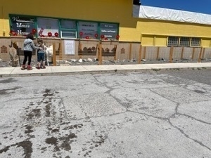
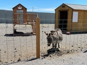
     

    IMG 2850IMG 2851


    The pumps were wonky and I had to go inside to ask for help. There, the woman behind the counter impatiently explained to me what I had done wrong. On my way out the door, I noticed The Book of Mormon for sale and a sign that said something like “Ask me about The Book of Mormon”. I should have just bought one or two gallons of gas but instead I bought a full tank at $4.39 per gallon I’m a chump-turned out there was a real gas station selling gas for $1 less per gallon about 30 miles away. Also, the pumps had semi-cute phrases on their screens. Did not make up for any of the three things-the in-my-face Mormon evangelism, the sad petting zoo, the sullen attitude or the price. I did not like about buying gas there and will be more careful to check the map before investing in a whole tank of rural gas from some rando independent gas station. Also, I got about 40 miles less out of that tank than I normally would have, so it was an even worse deal.
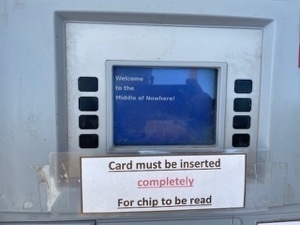
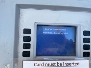
    IMG 2846

    IMG 2848

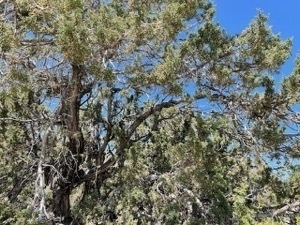
    I stopped at the Juniper Rest Area, just inside Idaho, and took some pictures of the juniper.
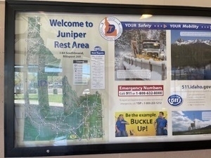
    IMG 2853

    IMG 2854

    The drive across Utah was beautiful except for the Salt Lake City region which has a definite SoCal vibe-but it’s Utah. The sprawl, the sun, the mountains which seem tall because they are right up against the sprawl, the bad air quality which blocks views of the moutnains, the freeways. To my eyes, the built environment is pretty ugly in that growth-at-any-cost kind of way. I saw a reader sign that encouraged people to drive less this weekend to protect air quality.

    I’m here to tell you that the freeways were packed on a Saturday afternoon. It’s 80 miles from Ogden to Provo. That’s about 10 miles shorter than Everett to Olympia according to my map. For me, that’s very sprawling. It’s also a much smaller region in terms of population.

    The first half of the drive from Ogden to Salt Lake, I-15 was under construction because they were adding express/HOT lanes. The design didn’t make sense to me because the HOT lane tolls were ridiculously cheap, between $0.20 and $0.60. Maybe because it was the weekend and not of lot of people were using them?

    I stopped in downtown Ogden for lunch at an Italian bakery. Staff at the cafe were super friendly and the dish of meat ravioli I had was OK. I noted with amusement that my iced chai was from Rishi Tea
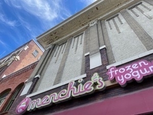
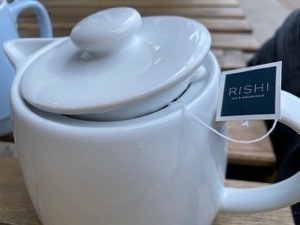
    IMG 2855IMG 2856

    Although I had stayed the night in Ogden once before, there seemed to be more to it than I remembered. Overall a nice downtown.

    I recorded about a minute's worth of ambient sound sitting outside at the bakery. Have a listen.

    Ogden UT Sapori Italian bakery & cafe.m4a

    Two people sitting outside at the table next to mine had their skin and clothes covered in chalk art. I and some passers-by complimented them on it because it was was cute and artistic.

    After driving in heavy traffic along I-15, I exited the freeway at Spanish Fork and drove on Highway 6 the rest of the way to I-70. Highway 6 is a beautiful drive, featuring some of the landscapes that I think of as typical for Utah. For example, there was a bunch of striation in the eroded parts of the reddish-orange mountain ranges that the highway goes through. There were some large rock formations that had interesting structure to them. I drove near a smouldering wildfire. I regret not stopping to take pictures at the scenic overlook but I wanted to get to my next stopping point after driving all the way from Boise.

    From Spanish Fork, It took about 2.5 hours with a stop at a janky, half-closed rest area to get from Spanish Fork to Green River, where I am staying for three nights. I noted with amusement that all of the gas stations between that rest area and Price advertise in large print that they have VERY CLEAN BATHROOMS!. The privately operated, taxpayer-funded rest area was mostly closed off to the public (for repairs? or something), not clean and the water fountains were turned off although the large Coca-Cola products vending machine selling bottled water for a lot of money seemed to be doing just fine.

    Green River is a small, windswept town that seems to depend heavily on the tourism overflow from Moab. and from tourism for Green River State Park  It’s a lot cheaper to stay here than Moab, but it’s also a lot farther from the parks.

    My motel has been very recently remodeled and quite cute. It’s called the River Rock Inn. It’s right on Main Street and very charming. Delicious home cooked breakfast was included in the very reasonable price of the room.
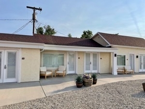
    Photo of courtyard and motel rooms at Ricer Rock Inn in Green River Utah

    SIgns at River Rock Inn entrance to courtyard. Sigsn say


    Later, I had an excellent turkey sandwich from a good, very busy restaurant that Jonathan found for me while I was doing battle on I-15. Thank you, Jonathan, for pointing out that I can ask for help from my family while driving when I complained that being the only driver in the car meant that I couldn’t research places to eat and stay while Dom was driving. Very insightful and helpful.


    As I watched TV in a futile effort to get tired enough to sleep, I saw a news story about a chalk festival in Ogden today.

    Tried to sleep but couldn’t so talked with Dad around 10:30pm about places to visit in Colorado and New Mexico. We agreed that I should visit Mesa Verde National Park. It was a very helpful conversation but it disturbed my neighbors because I was talking too loudly. I found out when they banged on the wall for 10 seconds. I felt really bad and quickly finished my conversation with Dad quickly and in a whisper.
     

    → 4:00 AM, Jun 12
  • June 11th-Boise ID

    Long drive from Portland to Boise. Talked to Joshua and Jonathan off and on for a good portion of the trip, where I had cell service. Got second full tank of gas in Baker City, at a self-serve (?) gas station. I had to ask another customer if it was self-serve. He looked bemused.
    Got to Boise quite late. Had trouble finding a hotel room. Got the last one at a forgettable but clean inn and suites near a strip mall in town.

    Amazingly, I was tired but not drowsy for the entire drive. I can’t remember the last time that happened.

    Although my CPAP is working better now that I have the right nose pillow size attached to it, I still couldn’t sleep well. I was simultaneously exhausted from the drive and wired because I had started my month-long road trip.

    Tomorrow: On to Utah!

    → 4:00 PM, Jun 11
  • RSS
  • JSON Feed
  • Micro.blog